This mountain is sometimes called “Iron Mountain #2”. It is in the Mt. Gleason region of the western San Gabriels. This distiguishes it from 8000 ft “Big Iron” which is near Mt. Baldy.
I had been looking at Iron Mountain #2 for a few months. To reach it is a long hike or bike ride: 11 miles up the Mendenhall Ridge Road from Dillon Divide off Little Tujunga Canyon road, 10 miles up the Yerba Buena Trail, or 15 miles or so of biking from Mill Creek Summit over Mt. Gleason and then down and up to Iron. I chose the Mendenhall route since it only has one mile of downhills and 10 miles of uphills on the way up, so returning is 10 miles of downhill on the bike! When/if the USFS opens the Mt. Gleason Road to Lightning Point campground the hike will only be 3 miles each way. The road has been closed to “civilian” vehicles since the 2009 Station Fire.
I used Patrick O’Neill’s hiking blog for more information; he has over 300 pictures of his bike ride up Mendenhall Ridge to Iron Mountain. Not only did he do Iron, he hiked up Mendenhall Peak, and also down from the ridge and up Mt. McKinley and back to the ridge to continue his ride to Iron! Patrick has been recently licensed and is KK6KUM. Less than a week before my Iron #2 ride he hiked and activated Big Iron.
His GPS track:
I monitored the weather forecast; I wanted a day in which the winds were from the West, not the North East so I could have a bit of a tail wind on the way up. Also a day that was not too hot. I saw from the daily graphs you can find for weather stations on “wunderground.com” that it would start to get much warmer around 10AM, so I wanted my uphill ride over by then.
I also checked the solar weather to check for quiet band conditions
http://www.swpc.noaa.gov/forecast.html
I started early at 5:20AM, the stars were out, it was cool in the 50s and very quiet and peaceful. Starting altitude at Dillon Divide is 2700 ft. After a little while I found I was more comfortable pushing the bike in the dark rather that riding by my headlamp on the dirt road. It had been recently graded and there were rocks and soft spots in places. I really don’t mind pushing the bike; I had a gallon of water and my radio gear, it’s easier pushing the bike than carrying that cargo on my back!
I reached my first goal, the power lines at Highline Saddle, 3630 ft altitude and 2.4 miles in.

Magic Mountain in the background

Recently graded road. At least the USFS had cleared any rock slides off the road! I pushed the bike alot on this trip.

The next goal 4350 ft and just over 4 miles, the turn off to the old Mendenahall Peak road. Highway 18 apparently.

From here you ascend along the south side of the ridge, then descend 150 ft over about a mile and return to the North side
Continue the ascent

Snow Benchmark across Pacoima Canyon

View of Mt. Lukens, with shoulder of Condor Peak to the left

Finally I get a clear view of Iron Mountain, perhaps a mile or so away. The road is pretty gentle here which was good since my legs were tired by this point. The giant concrete “toothpicks” in the picture are interlocked together to make retaining walls.

Up to a saddle, Iron can be reached an easy half mile up the grassy ridge from here. I took this picture on the way down, since I chose a different route up…

I rode a little further up the road, packed the gear in my day pack, then went up steeply to the ridge through brush. It was OK but at one point I scrambled up a burnt log to avoid dried out Poodle Dog bush on either side.

Nice grassy ridge, elevation gain from the road to the summit is maybe 150ft

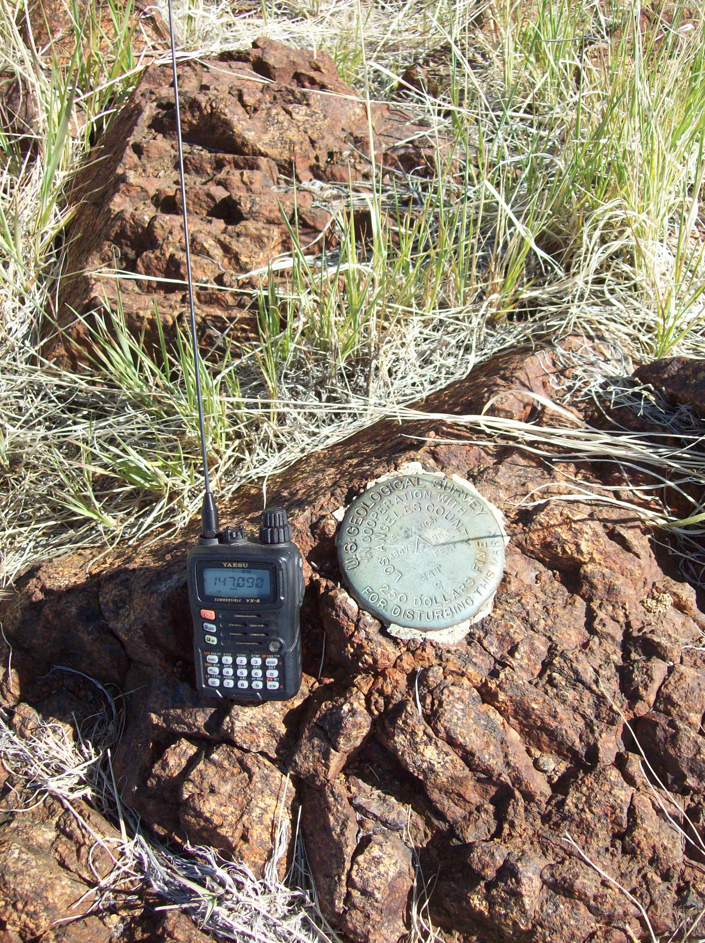
Finally, the summit benchmark! There were a few signatures in the summit register.
I turned on the HT and right there was Mike N6MKW who was near the summit of Peak 4202 W6/CT-150 above the Angeles Crest Highway. A few minutes later he was at the summit and we had a summit to summit QSO.
The antenna at the summit

Thanks to all for the contacts!
2m FM: N6MKW, WB6EFL WA9STI
20m CW: AD7IR/M K7TQ W7CNL K5WI NS7P K7NEW NA6MG K6TUY WA2USA N7WM W0MNA W6BUX KF5J KF7WNS K8TE
30m CW: WA6RIC W7RV N7CW NK6A K0YO KK7EL AE9F K6EL K9ZMD
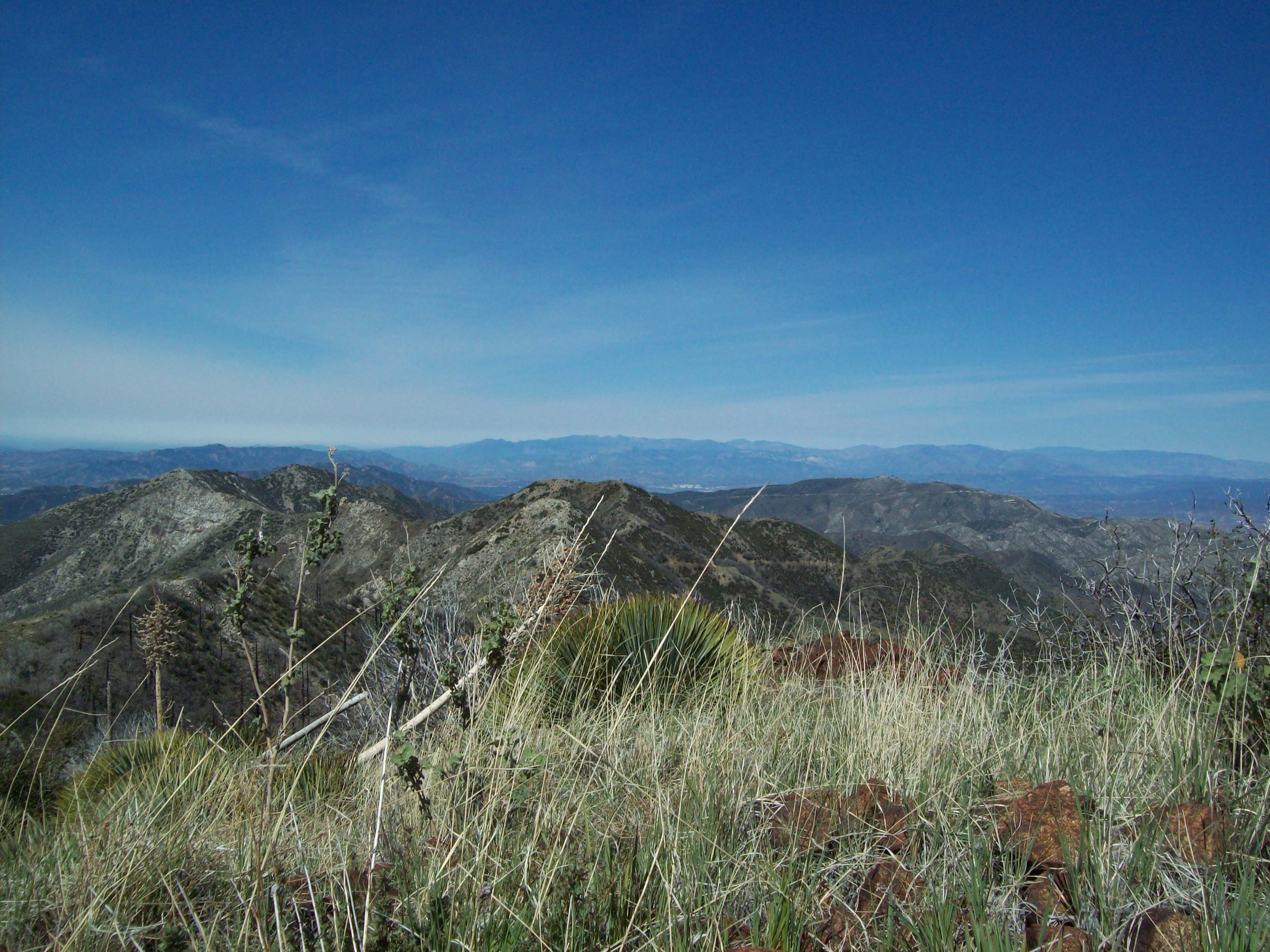
Mt. Gleason to the Northeast. The Mendenhall Ridge road goes down to Indian Ben Saddle, then up to where it will meet the Santa Clara Divide Road then on to the summit

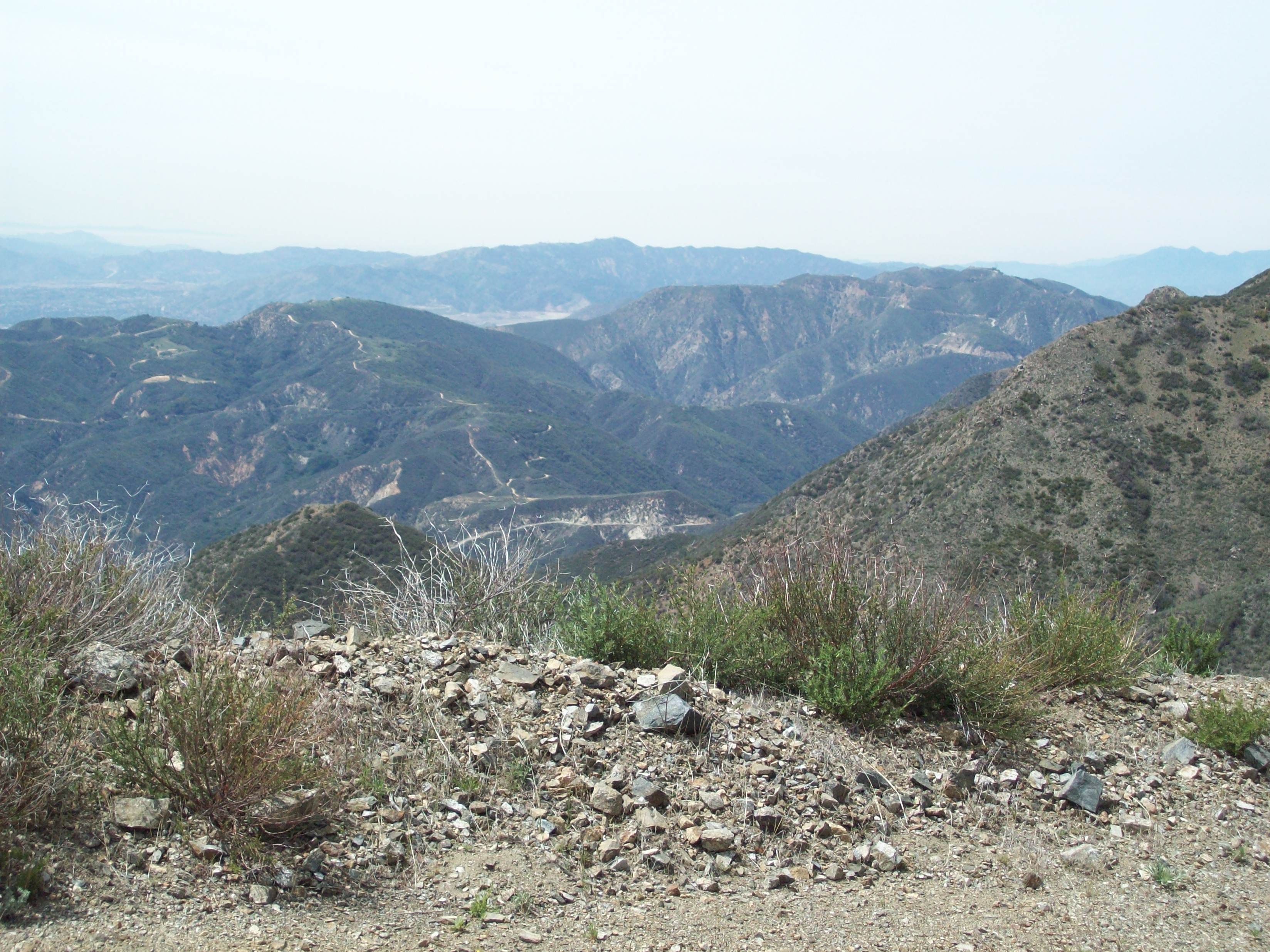
View back down Mendenhall Ridge to the West
View South showing the route to Condor Peak, about 3 miles. I wonder if those water tanks have water in them?

The same picture showing where Mike is on Peak 4202 W6 CT-150. If you click on the picture your browser should be able to zoom in. You can go to his blog and see if you can make out where I am! http://mikakw1sota.blogspot.com/2014/04/pt-4202-w6ct-150.html

And I too was there, too.

Magic Mountain and Snow Benchmark to the Northwest

A snowy Mt. Baldy far to the East

After another contact or two with Mike on 4202, and KR6AL Frank on the Catalina Repeater, headed back down to the road. The rocks and boulders looked rusty, so I guess maybe they really are Iron Oxide and there is Iron on Iron Mountain

I had put the bike down for a nap so it would be well rested.

Ready to head down

Mendenhall Ridge

I think this may be at Iron Mountain Saddle, but my geography is a bit weak. Snow Benchmark in the background

View back East along Mendenhall Ridge

Spring flowers

New growth of chaparral since the Station Fire of 2009

Now for a little uphill

Kagel Mountain L and Los Pinetos (“Fernando 2 Benchmark”) R
Approaching Highline Saddle

Enjoying some shade and a nice road

Almost down to Little Tujunga Canyon and the end of this adventure…

The USFS road grader!

During the ride, I drank five pints out of the eight I had taken. I immediately had a cold coke from the cooler in the Jeep when I arrived. The mid day temperature was in the low 70s on the mountain (with bright hot sunshine) and in the 80s back at the Jeep. I think if you were to hike this you would need two gallons of water.
It took four hours up the road to the beginning of the scramble to the ridge, and two hours to ride back down. Total elevation gain is about 3200 ft out, 300 ft back. 11 miles each way on the road, plus a little in hiking to the summit.
73!
Hal
N6JZT
